Land transactions in Kenya involve much more than simply obtaining a title deed or conducting an official search. One of the most overlooked yet legally significant documents is the Registry Index Map (RIM).
A Registry Index Map forms the foundation upon which many parcels of land under the general boundaries system are identified, registered, transferred and managed. Despite its importance, many landowners, purchasers, developers and even investors rarely appreciate its legal significance until boundary disputes, overlapping titles or survey discrepancies arise.
This guide explains everything you need to know about Registry Index Maps in Kenya, their legal effect, their limitations, and why every prudent purchaser should review a RIM before purchasing land.
What is a Registry Index Map (RIM)?
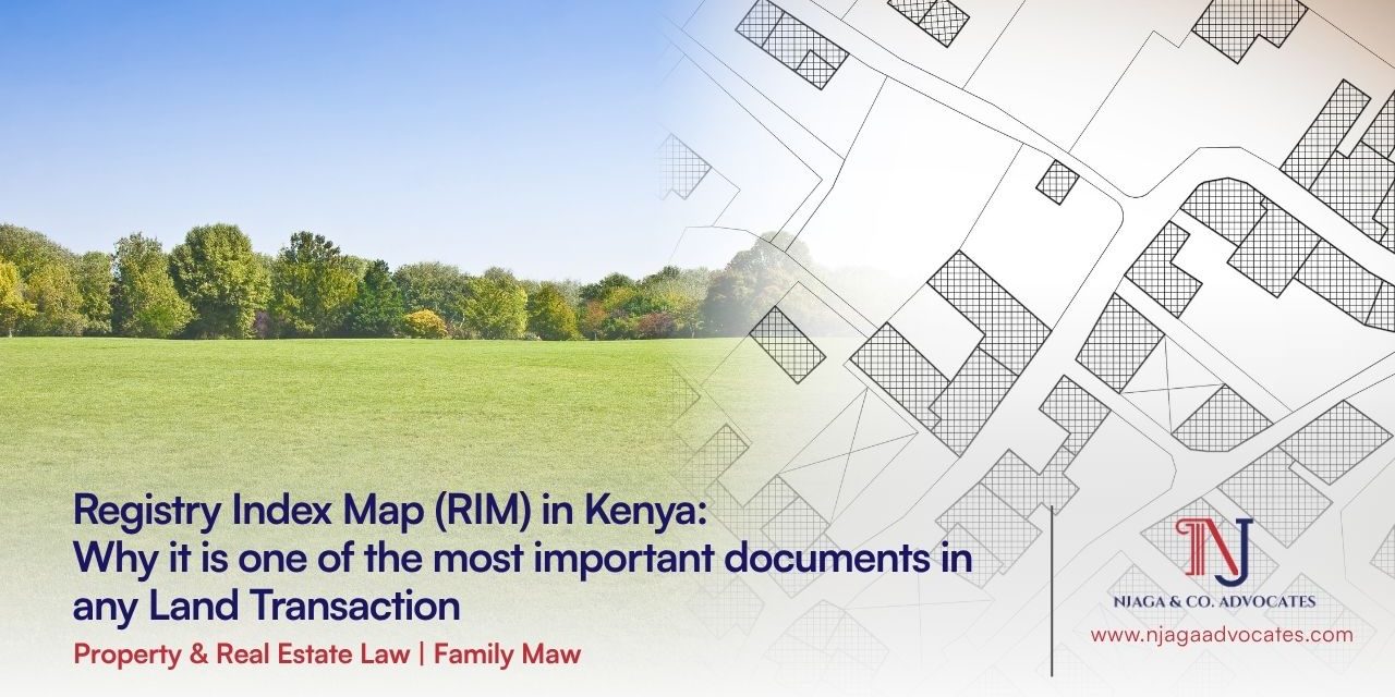
A Registry Index Map is a cadastral map, an official, scaled diagrammatic record, that shows the location, shape, size and boundaries of every registered parcel of land within a defined registration section, in relation to the parcels surrounding it.
Unlike a title deed, which is a legal instrument certifying ownership, the RIM performs a spatial function: it fixes a parcel in physical space and links the parcel number appearing on the map to the corresponding entry in the land register. It is prepared and maintained by the Directorate of Surveys (Survey of Kenya) and is referred to in the Land Registration Act, 2012 (Cap. 300) simply as the “cadastral map.”
Simply put, it is the official government map that illustrates how individual parcels of land relate to each other within a particular registration area.
In practice, the RIM is what allows a registrar, surveyor or advocate to answer the most basic due diligence question of all: does this parcel actually exist, where the seller says it does, and in the shape the seller says it takes?
How is RIM different from a Deed Plan or a survey plan?
A Deed Plan is a large-scale plan prepared for a single parcel, historically used under the older registration statutes, such as the repealed Registration of Titles Act (Cap. 281) and Land Titles Act (Cap. 282). A RIM, by contrast, is prepared for an entire registration section at once, capturing many contiguous parcels on a single sheet.
A survey plan (or Preliminary Index Diagram/Plan of Subdivision) is typically the surveyor’s working document produced during subdivision or first registration, which is subsequently incorporated into the RIM once the Director of Survey approves and files it. RIM is therefore the consolidated, registry-grade successor of these individual working plans. Under the ongoing title conversion exercise, RIMs are progressively replacing Deed Plans as the primary cadastral instrument for registration.
Note on Land Conversion: Under Kenya’s ongoing land registration digitization process (ArdhiSasa), all old registers are being converted to the Land Registration Act (LRA), 2012. Consequently, properties are shifting toward highly precise, geo-referenced cadastral maps that fuse the master-view utility of a RIM with fixed-boundary accuracy.
What laws govern the preparation and use of RIMs in Kenya?
RIM sits within a layered legal framework:
- Constitution of Kenya, 2010 – Protects the right to property while requiring an efficient land administration system founded on transparency and certainty.
- Land Registration Act, 2012 (Cap. 300) – the primary statute. Section 15 requires the survey office to prepare and maintain the cadastral map (RIM) for every registration unit, geo-referenced and surveyed to prescribed standards. Section 16 gives the survey office power to alter boundary lines and prepare new editions of the cadastral map, only on the Registrar’s written instructions. Sections 17 to 20 govern further surveys, general and fixed boundaries, and the maintenance of boundary features.
- Survey Act (Cap. 299) governs the conduct of land surveys, the licensing of surveyors, and the technical standards (triangulation, geo-referencing, beacon placement) that feed into the preparation of the RIM.
- Land Registration (Registration Units) Order, 2017, made under section 6 of the LRA, operationalises the constitution of registration units and directs the survey authority to prepare cadastral maps and conversion lists for each unit, which are then gazetted.
- Physical and Land Use Planning Act, No. 13 of 2019 (PLUPA), while distinct from the LRA, PLUPA planning decisions (change of user, subdivision approvals) rely on RIM data to assess a parcel’s precise location and dimensions before permission is granted.
Sectional Properties Act, 2020 requires sectional plans to be geo-referenced and authenticated by the Director of Survey before registration, again anchoring individual unit boundaries to the underlying RIM.
Who prepares a RIM, and what methods are used?
The Directorate of Surveys, under the Ministry of Lands, is the office or authority responsible for preparing and maintaining RIMs under section 15 of the LRA. The authority uses information obtained from licensed surveyors, cadastral surveys, mutation forms, subdivision plans, geospatial information, etc. Preparation typically follows one of two survey methods:
- Chain survey – a simple, ground-based measurement method historically used for large rural areas, allowing quick, cost-effective mapping of many parcels at once.
- Aerial photography and photogrammetry are used to capture large tracts efficiently, particularly for expansive rural registration sections, and are increasingly supplemented by satellite imagery and GPS/GNSS georeferencing for greater precision.
Because the chain-survey method prioritizes coverage and speed over millimetre precision, boundaries on many older RIMs remain “general boundaries” under section 18 rather than fixed boundaries, a distinction addressed further below.
How is a RIM Created?
The creation of a RIM follows a rigorous administrative and technical process involving the following pipeline:
- Ground Surveying and Data Collection: Government or licensed private surveyors visit the site to mark out coordinates using aerial photography, satellite imagery, or traditional ground equipment (Total Stations/GPS).
- Compilation and Computations: The field data is computed and drawn into a draft layout plan, ensuring the new plots align with existing base maps.
- Preparation of a Cadastral Map: A cadastral map (RIM) is drafted showing each parcel, its plot number, boundaries and relationship to neighbouring parcels, together with a conversion list where old numbering is being migrated to new parcel numbers.
- Authentication by Survey of Kenya: The draft cadastral maps are reviewed, cross‑checked against other land records and registers to ensure accuracy and completeness, then approved by the Director of Surveys as the authoritative representation of parcels in that unit.
- Printing and registration: Once approved, the RIM is printed (traditionally on large blueprint-style sheets) and lodged as part of the official survey records and land registry system, forming the spatial reference for registered parcels in that unit.
What are the Key Components and Contents of a RIM?
A standard sheet of a Registry Index Map contains vital visual data such as:
- Registration Section/Block Number: The specific administrative area name (e.g., Nairobi/Block 100 or Kiambu/Donyo-Sabuk/).
- Parcel Numbers: Unique identifiers for every plot (e.g., Plot 452).
- Scale of the Map: Indication of standard scaling ratios (e.g., 1:2,500 or 1:5,000) used to calculate real-world measurements.
- Boundary Lines: Distinct lines marking out the edges of each plot.
- Physical Features: Road reserves, rivers, railways, and public utility allocations adjacent to private parcels.
- Sheet Number: Identifies which specific segment of the wider regional map grid you are looking at.
- Editions & History – records of updates or amendments.
- North Arrow: Shows map orientation.
Why is the RIM so important in Kenyan land practice?
Its importance runs across several dimensions of land administration:
- Existence verification – a RIM confirms that a parcel is not a “paper-only” or fictitious claim; if a numbered parcel cannot be located on the current RIM, that is an immediate red flag in due diligence.
- Conveyancing due diligence – A search on a title deed tells you who owns the land; a RIM search tells you where the land actually sits geographically. It prevents you from buying “ghost land” or a property that physically sits inside a riverbed or a highway expansion zone. No property purchase, charge or lease should be finalized without confirming that the parcel’s RIM entry matches the title, the physical site, and the vendor’s representations.
- Fraud prevention – by mapping a wider area rather than one isolated plot, RIMs make it materially harder to sell overlapping, duplicated or non-existent parcels, a key motivation behind their expanded use in the ongoing title conversion exercise.
- Foundation for title conversion – the Ministry of Lands’ nationwide migration from the old, fragmented registration statutes to the unitary Land Registration Act, 2012 regime depends on approved RIMs and conversion lists for every registration unit.
- Subdivision and reparcellation – any subdivision, amalgamation or reparcellation of land must be reflected on an updated RIM before the resulting parcels can be separately registered and titled.
- Boundary dispute resolution – RIMs, alongside filed survey plans, are the primary reference documents courts and registrars turn to when adjudicating boundary and encroachment disputes.
- Physical planning decisions and risk assessment – change of user, development permission and zoning decisions under PLUPA rely on the RIM to confirm a parcel’s precise location, size and neighbouring land uses.
- Rural land accessibility – the relatively low-cost chain-survey and aerial methods used for RIMs have made it possible to register vast rural landholdings that would otherwise have taken decades to survey individually.
Key Considerations for Persons Intending to Buy Property from a Deceased’s Estate
If you intend to purchase property that previously belonged to a deceased person, you must conduct rigorous due diligence before committing any funds. Here are the critical checkpoints:
- Verify That a Confirmed Grant of Representation Exists: The seller must hold either a confirmed grant of probate (where the deceased left a will) or a confirmed grant of letters of administration (where the deceased died intestate). An unconfirmed grant is insufficient, Section 55(1) prohibits any distribution before confirmation.
- Check the Schedule of Distribution: Ensure the property you are buying is explicitly listed in the court-approved distribution schedule.
- Conduct a Thorough Title Search: Conduct both an ordinary searchand a green card search at the relevant Lands Registry. The green card search will reveal the full ownership history of the property, including whether the registered owner is deceased and any encumbrances, cautions, restrictions, or inhibitions on the title.
- Check the Succession Court File: Review the succession court file to confirm:
- Whether the grant has been confirmed
- Whether there are any pending disputes, objections, or applications for revocation of the grant
- That all beneficiaries are accounted for and their consent obtained where necessary
- Verify the Identity and Authority of the Seller: Confirm that the person selling the property is the duly appointed and confirmed administrator or executorof the estate, and that they have authority under the confirmed grant to sell specific estate assets.
- Obtain Spousal Consent Where Required: Section 93 of the Land Registration Act requires spousal consent before any transaction in matrimonial property can occur. This is particularly important in succession sales involving a matrimonial home.
- Check for Land Control Board Consent: Where the property is agricultural land, confirm that Land Control Board (LCB) consenthas been obtained under the Land Control Act. Transactions without LCB consent are void.
- Confirm That All Debts and Encumbrances Are Cleared: Ensure that all land rates, rent arrears, and any mortgages or charges on the property have been discharged or that provision has been made for their payment from the estate.
- Engage a Qualified Advocate: Never purchase property from a deceased estate without the guidance of a qualified advocate. Section 93 of the Law of Succession Act protects purchasers who transact with a confirmed personal representative, but this protection is not absolute where fraud or irregularities exist.
- Do not pay the purchase price until all succession prerequisites are fulfilled. Structure payment to be conditional on production of the confirmed grant, transmission, or assent. Never release funds against a mere promise that succession will be completed after payment.
Practice Note
In every property transaction we handle, we insist on a physical site visit conducted alongside a licensed surveyor, cross-checking beacons and boundaries on the ground against the RIM entry for the parcel – not merely relying on the title deed or a search certificate in isolation. Property Due Diligence Guide
Can a RIM be amended once it has been prepared?
Yes. Section 16 of the LRA expressly empowers the survey authority to rectify the line or position of any boundary shown on the cadastral map, based on an approved subdivision plan, and to prepare new editions of the map as needed.
However, this power is not exercised unilaterally: any correction must be made only on the written instructions of the Land Registrar, in the prescribed form, and in accordance with the Survey Act and its subsidiary regulations. This ensures that boundary amendments, which can materially affect neighbouring owners, pass through a formal, accountable process rather than informal redrafting.
Common triggers for amendment include:
- Parcels are subdivided or consolidated
- Boundary corrections are approved
- Correction/Rectification of Survey errors
- New survey data is submitted by licensed surveyors
- The gazetted conversion exercise itself, which is systematically replacing old Deed Plan references with updated RIM sheets.
What Should Landowners, Buyers & Investors Consider About RIMs?
- Always cross-check the RIM with the title deed and green card.
- Ensure the RIM is the latest edition.
- For boundary disputes, request a re-survey.
- For subdivisions, ensure the mutation aligns with the RIM.
- For digital transactions (Ardhisasa), confirm the RIM is uploaded and geo-referenced.
What are the Limitations and Risks associated with a RIM?
While invaluable, investors must watch out for inherent limitations:
- The “General Boundaries” Loophole: Many traditional RIMs operate on the principle of general boundaries. This means physical features like hedges, fences, or stone walls are taken as the boundary indicator. The exact mathematical coordinates might vary slightly, sometimes leading to minor acreage discrepancies on the ground.
- Lag in Updating Manual Records: In registries that haven’t fully transitioned to the digital ArdhiSasa platform, there can be a delay between a physical plot subdivision and the actual drawing update on the master RIM sheet. This opens a window for fraudulent double-selling.
- Paper Wearing: Old, physical sheets of RIM maps at regional lands offices can become torn, blurred, or illegible over decades of manual handling, making accurate reading difficult without modern digitization.
- Interpretation Challenges: Non‑professionals may misread scales, boundary lines, or parcel shapes.
- Scale constraints – a single RIM sheet may cover a very large area (in some rural registration sections, tens of thousands of acres), meaning small on-the-ground discrepancies can be difficult to detect from the map alone.
- Currency of the map – a RIM reflects conditions as at its last approved edition; recent subdivisions, encroachments or informal boundary changes may not yet be captured until the map is formally updated.
- No substitute for a ground survey – because RIM boundaries are general, a licensed surveyor’s ground verification (beacon identification, re-measurement) remains essential wherever certainty as to the exact boundary line is required, particularly for high-value transactions or contested parcels.
How do you obtain a RIM copy for a transaction?
In practice, the process to obtain a RIM copy usually involves:
- Identifying parcel details: Use the title deed to confirm the registration unit, section/block and parcel number that you wish to trace on the RIM.
- Visiting Survey of Kenya or relevant county survey office: For Nairobi and environs, practitioners typically visit the Survey of Kenya offices in Ruaraka; for other counties, the relevant local survey or land registry office holds the RIM sheets.
- Requesting the relevant RIM sheet: Make a formal request (or application) for the specific sheet covering your parcel, sometimes using internal file references or sheet numbers maintained by the office.
- Payment of prescribed fee: Pay the applicable fee per sheet at the cash office to obtain a certified copy.
- Collection of certified copy: The survey office retrieves the original vellum or master copy, produces a duplicate (often on large blueprint‑style paper), and a surveyor signs and stamps it as a certified copy for official use.
Frequently Asked Questions
Q: Is a RIM the same as a title deed?
A: No. A title deed is the legal instrument certifying ownership; the RIM is the spatial/cadastral record showing where the parcel lies and its shape relative to its neighbours. They work together; the title records rights, the RIM records location.
Q: Is a RIM the same as a survey map?
A: No. A RIM is a cadastral index map, while survey maps are detailed plans of specific parcels.
Q: Can I buy land that does not appear on any RIM?
A: This is a significant risk indicator. If a numbered parcel does not appear on the current RIM for its registration section, its physical existence and boundaries cannot be independently verified, and the transaction should not proceed until the discrepancy is resolved with the land registry and survey authority.
Q: Who can access or request a RIM extract?
A: Any member of the public may request a RIM extract from the Survey of Kenya or the relevant county land registry, generally by quoting the title or parcel number and paying the prescribed fee.
Q: Does a RIM show the exact size of my land?
A: It shows an approximate area, generally consistent with the title deed’s stated acreage, but section 18 of the LRA treats RIM boundaries as approximate unless separately fixed. Where precise acreage is critical, for example, in a high-value commercial acquisition, an independent ground survey by a licensed surveyor is advisable.
How Njaga & Co. Advocates LLP Can Assist
At Njaga & Co. Advocates LLP’s Property & Real Estate Law, we appreciate that successful conveyancing goes far beyond conducting an official search or reviewing a title deed. Comprehensive legal due diligence requires a careful examination of the Registry Index Map, survey records, mutation forms and the broader cadastral history of the property to identify potential risks before completion.
Our conveyancing team provides end-to-end legal support to individuals, businesses, developers, lenders and foreign investors by:
- conducting comprehensive legal due diligence on land and property;
- reviewing Registry Index Maps, mutation forms and survey records;
- identifying boundary inconsistencies, access issues and title anomalies;
- advising on subdivisions, amalgamations and boundary regularisation;
- liaising with licensed surveyors, the Survey of Kenya and land registries;
- assisting with rectification and regularisation of land records;
- advising on boundary disputes and land registration issues; and
- preparing, reviewing and completing secure property sale and purchase transactions.
If you require legal assistance with land due diligence, Registry Index Map reviews, survey-related issues, boundary disputes or any aspect of property acquisition in Kenya, Njaga & Co. Advocates LLP is ready to assist with practical, commercially focused and legally sound advice.
Disclaimer: This article provides general information and does not substitute legal advice on specific circumstances of any individual or organization. While the information is accurate as of the date published, we cannot guarantee it remains accurate at the time you read it or that it will stay current. Before acting on any of this information, please seek professional legal advice tailored to your situation.